-
Engineering an analytics pipeline for water logger data and environmental event detection
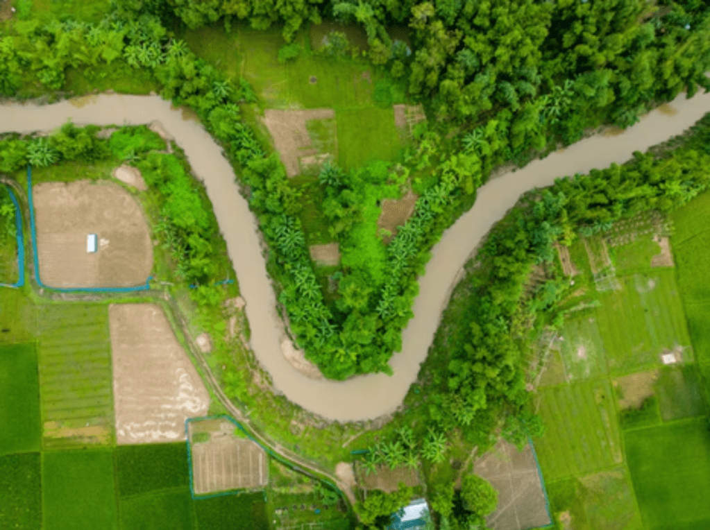
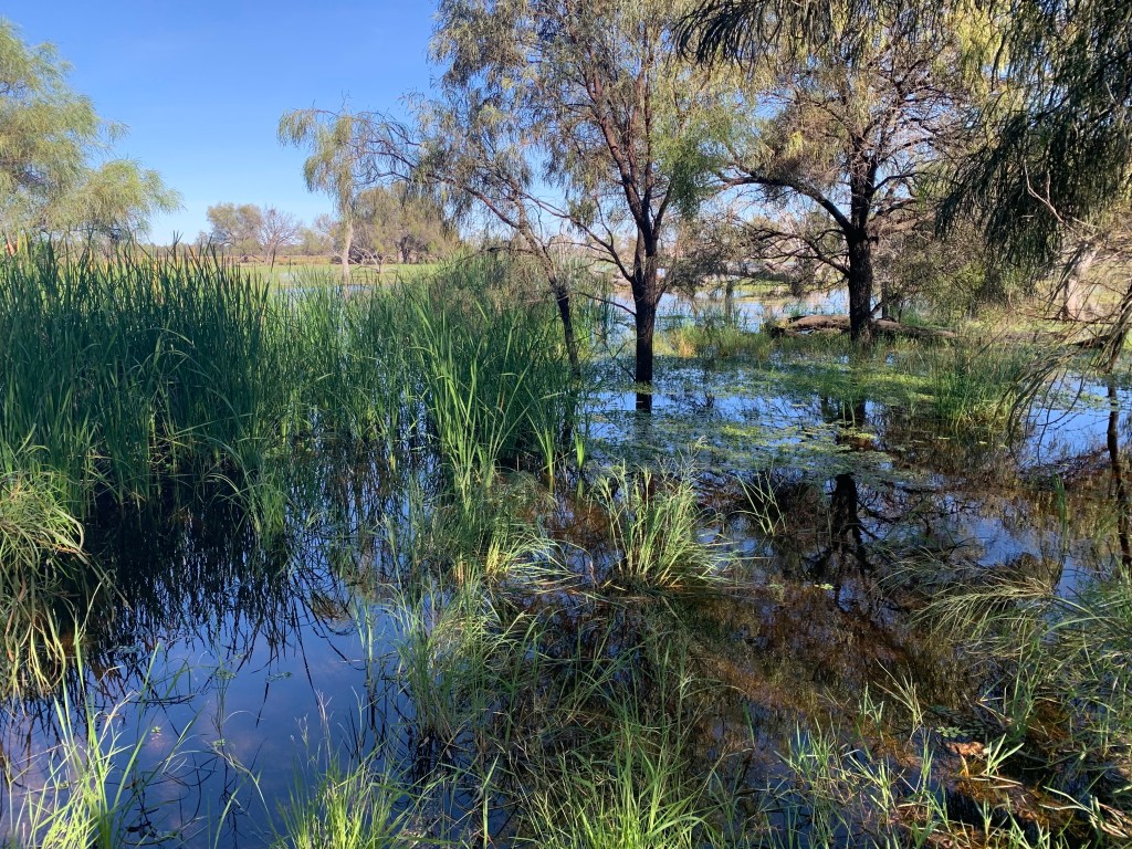
Photo by Abdul Kayum on FreeImages Validating satellite-derived wetland inundation maps requires a ground-truth baseline of water levels over time. In-situ submersible water level loggers provide this continuous time-series data. However, raw data downloads from field loggers are highly granular, noisy, and prone to environmental fluctuations, making them unsuited for direct comparison with satellite imagery.…
-
From manual work to smart automation: Mapping flooding in wetlands
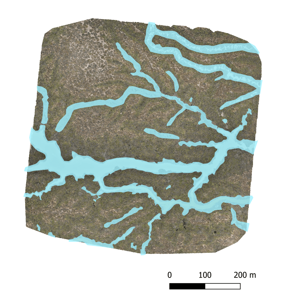
Using AI to map wetland flooding using satellite imagery. Image by Marie Attard I’ve been working on a fascinating challenge in the NSW Murray-Darling Basin: taking massive amounts of environmental data and using automation to map where water flows. Tracking large-scale wetland flooding and water movements Traditionally, tracking floods and water movement across millions of…
-
Building a reproducible spatial data pipeline: Python workflows for basin-scale wetland hydrology
Murray Darling River. Photograph by Marie Attard The NSW Murray-Darling Basin spans one of Australia’s most complex river and wetland networks, making large-scale geospatial analysis a challenge. To map water dynamics effectively across this region, I built a reproducible Python workflow that transforms raw geospatial data into actionable insights, helping uncover wetland distribution patterns and…
-
Toothed whales from space: Counting stranded individuals using optical and SAR satellite imagery
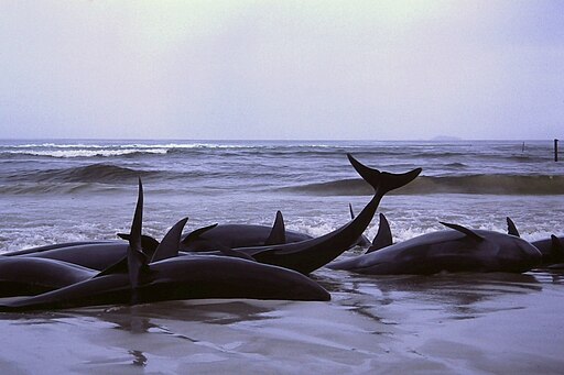
Photo credit: 1986 beached whales in Flinders Bay” by Bahnfrend is licensed under CC BY-SA 3.0. Cetaceans—whales, dolphins, and porpoises—play a crucial role in marine ecosystems. Their health and population trends serve as indicators of oceanic well-being, helping scientists understand environmental changes and emerging threats. One of the most valuable sources of information about cetacean…
-
Monitoring seabird populations on South Georgia: Advancements in remote Sensing
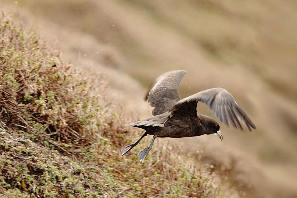
Credit: White-chinned petrel taking off. Photo by François Guerraz. Creative commons licence. South Georgia hosts globally important populations of seabirds, but many of these populations are declining due to human impacts. Four species of albatrosses and white-chinned petrels are particularly affected by bycatch from fishing activities, while South Georgia shags are experiencing declines linked to…
-
Citizen science campaign: Monitoring wandering albatrosses using very-high resolution satellite imagery

Albatrosses, including the iconic wandering albatross with its record-breaking wingspan, are facing serious threats to their survival. With more than 100,000 albatrosses dying annually as a result of bycatch in longline fisheries, combined with invasive predators and disease, these majestic seabirds are in urgent need of effective conservation actions. Our citizen science campaign, launched as…
