Using AI to map wetland flooding using satellite imagery. Image by Marie Attard
I’ve been working on a fascinating challenge in the NSW Murray-Darling Basin: taking massive amounts of environmental data and using automation to map where water flows.
Tracking large-scale wetland flooding and water movements
Traditionally, tracking floods and water movement across millions of acres is incredibly slow and manual. To solve this, our team introduced a system called Automated Inundation Monitoring (AIM). Think of it as a smart data recipe: it automatically takes satellite pictures from space, blends them with land elevation data and farming maps, and accurately pinpoints where water is sitting on the floodplains.
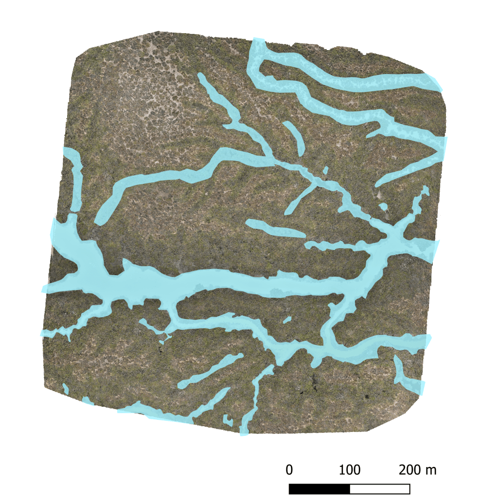
Of course, an automated system is only good if you can trust its outputs. To prove our system worked, the Water and Wetlands team ran a quality check. We took the maps automatically generated by our system and compared them against high-resolution pictures taken by drones on the ground.
The automated system was highly accurate in the Lower Lachlan floodplain, especially when mapping larger bodies of water.
Expanding automation across NSW
Now that we proved our automated system works well in one area, the next logical step was to see if we could scale it up. Can a system trained on one floodplain handle the diverse, unpredictable wetlands of an entire state?
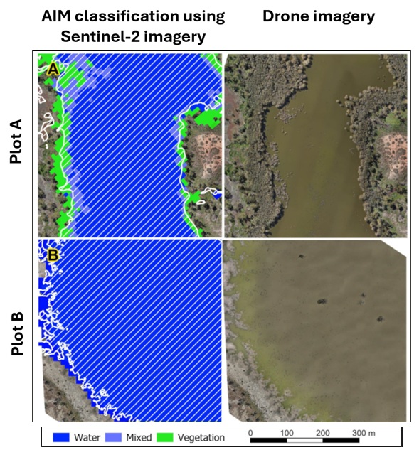
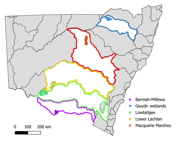
To find out, we expanded our tests across six different regions of New South Wales. We wanted to see how accurately our automated satellite system could classify the land into three simple categories:
- Open water
- Vegetation (plants and trees)
- Mixed water and vegetation
To double-check the system’s accuracy, we compared these satellite predictions against our own “ground truth” data—detailed drone imagery that we manually reviewed and tagged.
Right now, the computers are crunching the numbers. We are processing the final results to see just how well the automation performed across the state. Once finalised, these insights will be handed over to land managers, giving them a powerful, data-driven tool to make smart decisions about water usage across the entire NSW basin.
